 Improvement in tornado and severe thunderstorm lead times and false alarm reduction, early warning of lightning ground strike hazards, and improved routing of commercial, military, and private aircraft over oceanic regions where observations of thunderstorm intensity are scarce are just some of the many features that the first operational lightning mapper ever flown in space will provide when the GOES-R Satellite launches this month.
Based on years of research, the Geostationary Lightning Mapper, or GLM, is a revolutionary new instrument that will measure total lightning (in-cloud, cloud-to-cloud and cloud-to-ground) activity continuously over the Americas and adjacent ocean regions with near-uniform spatial resolution.
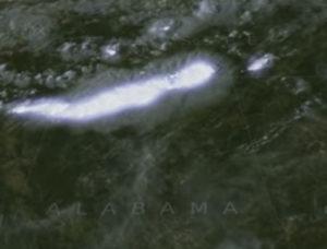
Severe weather often exhibits a significant increase in lightning activity many minutes before radar can detect a potential storm. This data visualization shows actual lightning measurements captured by an array of ground-based lightning detectors capable of tracing how lightning propagates through the atmosphere. It simulates how the GOES-R Geostationary Lightning Mapper will monitor atmospheric flashes in and around potentially severe weather. This technology could provide critical minutes of valuable warning time in advance of approaching severe storms.
For more information about the Geostationary Lightning Mapper, or GLM, click here
