2019 Skywarn Recognition Day

2019 Skywarn Recognition Day6 pm Friday, December 6 to 6 pm Saturday, December 7

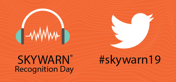
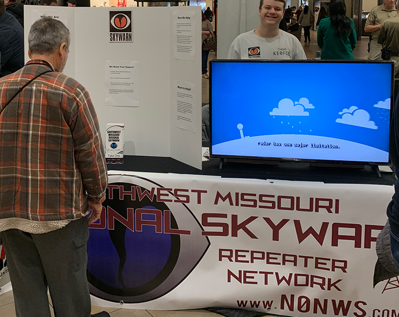
In 1999 the US National Weather Service began reaching out to weather spotters across the country to thank them for their volunteer service. NWS offices across the country will once again be opening their offices to amateur radio operators to participate in this great amateur radio event.

Locally, we have made some changes this year. To start, we will be having a Meet and Greet at the NWS office Friday evening Dec. 6 from 6 pm to 8 pm. In addition to amateur radio spotters, we will also look forward to extending an invitation to our emergency management partners that oversee SKYWARN groups in their jurisdiction.  It will be a chance to meet the meteorologists as well as each other.   In order to properly plan for the number of attendees, we ask that you RSVP with Warning Coordination Meteorologist Steve Runnels by emailing him at steve.runnels@noaa.gov.

In addition, rather than having the HF operating stations at the weather service, we are reaching out to operators across our region to operate and invite spotters in their counties to join the activity. This year there will be stations in Douglas County, Jasper County, Benton County and Greene County. This is a trial to see if we can get more participation from spotters across the region. Next year we hope to rotate those to other counties.

On Friday evening at 6 pm on the WX_TALK Echolink Conference we will once again be the leadoff station to start the event. We will be operating on Echolink from the NWS office. Then at 8 pm on the 145.49 repeater and linked system, we will hold a special check in net. Individual stations are encouraged to check in and regional partners who have their own nets are encouraged to have check I nets and turn in their numbers. Please, if doing so, make certain your spotters know the NWS appreciates their service and this day is for them! At 8:30 pm, we will move to the SMLRS system for a special check in net there. We would appreciate if you would pick one and not check into both as we are turning in our numbers for this event. (Duplicate check ins do not count!)

During the entire event, we will have HF stations operating under the NWS call sign N0NWS!

Northern AR Quake Rattles Area

Gassville, Arkansas Earthquake September 12, 2019

Many folks throughout the Springfield, Missouri County Warning Area say they felt this morning’s Magnitude 3.7 earthquake which struck at 1:42 a.m. in northern Arkansas. The United States Geological Survey says the quake was centered about 12 miles south-southeast of Gassville, Arkansas at a depth of around 11 miles.

So far there are no reports of damage or injuries.

The quake was felt over a wide area with reports of shaking coming in as far north as Lebanon, Missouri and as far west as Pittsburg, Kansas. To view an interactive ShakeMap of this morning’s earthquake provided by the U.S.G.S., click here.


SW MO Skywarn Field Day 2019

2019 ARRL_Field DayWhen: Saturday, June 22nd 1 p.m. – Sunday, June 23rd 1 p.m.
Where: Menards in Hollister, MO

Join Southwest Missouri Regional Skywarn for our Field Day event Saturday, June 22, 2019, starting at 1 p.m. Central and lasting 24 hours through Sunday, June 23, 2019, at 1 p.m. Central. We will be operating at Menards in Hollister, Missouri in the gravel parking lot on the south side of the property adjacent to the fireworks tent.

We plan to have one HF station in operation in addition to a separate VHF/UHF station which will include 6 meters single-sideband. We will also have a portable satellite station in operation in hopes of making contacts via amateur radio satellites. All stations will operate via emergency power including solar, and N0NWS will be the callsign that we use on the air.

Menards in Hollister is easy to find. Take Highway 65 and get off at the Hollister exit which is approximately at mile marker 9. At the bottom of the offramp, turn east. That will be a left turn if you are southbound coming from Springfield or a right turn if you are northbound coming from Arkansas. After this turn, merge right and then turn right at the next intersection which is Birch Road. Then simply follow Birch Road to the top of the hill until you see Menards on your left. You will find us toward the south side of the property not far from the fireworks tent. (Use the interactive map below for guidance).

We will be monitoring 146.420 MHz. FM simplex for talk-in use. We will also try to monitor the Southwest Missouri Regional Skywarn Repeater Network if you would like to contact us outside of simplex range.

We hope that you and yours will stop by and say hello. We’d love to have you help us make contacts. If you are not yet a ham, that’s not a problem. With a licensed control operator by your side, you can legally get on the air and talk. We look forward to seeing you there.

For more information about the ARRL Field Day, visit: http://www.arrl.org/field-day


2019 #SafePlaceSelfie Day

2019 Safe Place Selfie

(from the National Weather Service)

Wednesday, April 3, 2019, is #SafePlaceSelfie day!

If there was one extreme weather preparedness action you want your loved ones to take, what would it be? For many, that one action is to know ahead of time where their safe place is located. On April 3rd, 2019, at 11:11am local time, please join the National Weather Service and its Weather-Ready Nation Ambassadors to take a “selfie” and post with the hashtag #SafePlaceSelfie.

“What makes the #SafePlaceSelfie campaign so powerful is it’s simple message and call-to-action. If you’re sitting in your home or at your desk at work looking at Twitter, ask yourself ‘what if?’ Where would you go if life-threatening weather approaches your area? Spend a few minutes going to that safe place, take a selfie, and share over social media using the #SafePlaceSelfie hashtag. This campaign keeps it simple while making a paramount preparedness action fun and interactive. And most importantly, we can see it working.”

-Trevor Boucher, forecaster at the Las Vegas Weather Forecast Office

Here are some helpful suggestions:

  • Think about the hazards in your area where you would need to know where safe places or evacuation routes are located.
  • Get creative! Storm shelters, safe rooms, and basements are all good safe places from tornadoes and strong winds but think of other scenarios or hazards that may require other safe places.
  • What other preparedness actions make your safe place even safer? Having a NOAA Weather Radio? Emergency Kit? Family Communications Plan?
  • Encourage family, friends, and your social media network to post their #SafePlaceSelfie. Tag someone on your post and ask them, “Where is your safe place from extreme weather?”Feel free to ask questions and engage in dialog with the larger #SafePlaceSelfie social media community.

For more information, visit: https://www.weather.gov/wrn/safeplaceselfie

2019 Statewide Tornado Drill & Net

2019 Missouri Kansas Statewide Tornado DrillThe 2019 Missouri and Kansas statewide tornado drill will be held on Tuesday, March 5th at 10 a.m.

Starting at 10 a.m., a net will be held on all Southwest Missouri Regional Skywarn Repeater Network repeaters, on our EchoLink Node: N0NWS.R (291849), and via the Southwest Missouri Skywarn DMR Brandmeister Talkgroup: 31297. All stations who check in are encouraged to indicate whether you were able to hear your local tornado sirens and/or if your N.O.A.A. All Hazards Radio alert tone was activated.

This net will take place in lieu our regularly-scheduled Skywarn Training Net for Tuesday evening, March 5, 2019, at 7 p.m.

* Important Note: Due to the cold weather this year, some locations are announcing that they will not activate their tornado sirens to prevent possible damage to those sirens.

Why Participate?

Severe weather can strike at any time in Missouri, making it important for all of us to be prepared to find the most secure shelter available no matter where we are. The statewide tornado drill is an excellent opportunity for Missourians to practice their sheltering plans and ensure readiness in case of a severe weather emergency. The statewide drill provides schools, businesses, and families with an opportunity to test their planning and readiness to be able to quickly seek appropriate shelter in case of a real severe weather emergency. By practicing and increasing readiness across the state, Missourians will feel confident and prepared in the event of actual severe weather emergencies.

How to Participate

At 10:00 a.m. on the day of the drill, NOAA Weather Radios will alert listeners that the tornado drill has begun. *Outdoor warning sirens will also sound across Missouri. At this time, participants should practice taking cover in their designated shelter.

Schools, businesses and families are all encouraged to participate in the statewide tornado drill. Schools are encouraged to use the tornado drill as an educational tool for students by incorporating tornado facts and meteorological information and safety tips into their lesson plans.

Missouri’s annual Statewide Tornado Drill is part of Severe Weather Awareness Week, which includes:

  • Monday – Preparedness Day
  • Tuesday – Tornado Safety Day, including a tornado drill at 10:00 a.m.
  • Wednesday – Flash Flood Safety Day
  • Thursday – Severe Thunderstorm Day
  • Friday – NOAA Weather Radio Day

StormAware is using Facebook and Twitter to help provide severe weather facts and safety information in the days leading up to and during Severe Weather Awareness Week. Please like StormAware at facebook.com/StormAware and follow on Twitter at twitter.com/MoStormAware.

Photos from 2019 Severe WX Expo

The 2019 Severe Weather Expo at Battlefield Mall in Springfield, Missouri on Saturday, March 2nd was a huge success. A chilly early March day with snow on the way invited hundreds of people into the warm shopping center where several booths representing local media, storm damage recovery businesses, the National Weather Service, and Southwest Missouri Regional Skywarn were on display. Thank you to all who stopped by our booth and said hello. It is remarkable how many non-hams out there listen to the 145.49 and the rest of the Southwest Missouri Regional Skywarn Repeater Network during severe weather either via scanners or our live online Broadcastify feed!

Below are a few photos of the expo. Enjoy…

The SW MO Skywarn Booth staffed by Caleb KE0FOE

The SW MO Skywarn Booth staffed by Caleb KE0FOE


N0NWS 145.49 Trustee speaking with Michael, a new Meteorologist with the NWS Springfield, MO

N0NWS 145.49 Trustee Michael N0NQW (left) showing Michael, a new Meteorologist with the NWS Springfield, MO office, what we do with Skywarn


Clay KB0WZI demonstrating Amateur Radio at the Skywarn booth

Clay KB0WZI demonstrating Amateur Radio at the Skywarn booth


NWS Springfield Warning Coordinator Steve Runnels KD4OPZ staffing the NWS Booth

NWS Springfield Warning Coordinator Steve Runnels KD4OPZ staffing the NWS Booth & Tornado Simulator


Brad KA0KDW helping to staff the KOLR 10 booth

Brad KA0KDW (right) helping to staff the KOLR 10 booth


The Greene County OEM booth

The Greene County OEM booth


The Greene County ARES & CERT booth

The Greene County ARES & CERT booth


Foundation Recovery Systems Booth

Foundation Recovery Systems Booth


KY3 Storm Team booth

KY3 Storm Team booth


KTTS 94.7 FM Radio booth

KTTS 94.7 FM Radio booth


2019 Severe Weather Expo

2019 Severe Weather Expo at Battlefield Mall

1st Saturday in March: Saturday, March 2, 2019 from 11 a.m. to 2 p.m.

Battlefield Mall, Springfield, Missouri

Battlefield Mall will host the 2019 annual Severe Weather Expo. The event will take place in the JC Penney East Court and has free admission. This expo is designed to better equip Southwest Missouri communities to prepare for the upcoming severe weather of tornadoes, severe storms, and flash flooding. Southwest Missouri Regional Skywarn will join the National Weather Service and several other vendors with interactive displays and important information on what to do in case of severe weather.

Mark your calendars for Saturday, March 2nd from 11 am to 2 pm…Bring the whole family! An interactive map to Battlefield Mall is available below.

Missouri is known for its dangerous weather ranging from tornadoes to extreme flooding, and even winter storms. It’s important for Missourians to know about weather safety since we have the extremes. The Severe Weather Awareness Expo at the Battlefield Mall is to inform the community on how to keep their families safe before and after severe weather hits.

Trained spotters and volunteers from Southwest Missouri Regional Skywarn will be on hand as well to answer any questions you might have about getting involved with weather spotting via amateur radio. We hope to see you there.

Merry Christmas!

Merry Christmas from Southwest Missouri Regional Skywarn!

Merry Christmas from Southwest Missouri Regional Skywarn!

Southwest Missouri Regional Skywarn wishes you and yours a very Merry Christmas and Happy New Year.

Holiday Net Schedule:

The Tuesday evening Skywarn Training Nets are on hiatus throughout the holidays. There will be no Training Net on Christmas Day and New Year’s Day. Please join us on Tuesday, January 8, 2019, at 7 p.m. when the Skywarn Training Nets resume at the regularly scheduled day and time.

Meanwhile, the Sunday evening Skywarn Youth Nets are also on hiatus; they resume on Sunday, January 6, 2019, at 7:30 p.m.

Thank you all for your continued participation in these weekly nets. The Tuesday evening Skywarn Training nets offer a great opportunity for everyone throughout the Springfield, Missouri County Warning area and beyond to test their equipment and to practice operating during times of high-traffic on the air. You can hear the latest announcements regarding Skywarn and amateur radio in our area along with the severe weather outlook for the next few days.

The Sunday evening Youth and Family nets encourage kids, YLs, family members, and future hams (via licensed 3rd party traffic) throughout Southwest Missouri and around the world on EchoLink to get out on the air and enjoy ham radio. We look forward to your continued participation during 2019 as it encourages these folks to get on the air and to learn about becoming weather aware.

Deadly Severe Weather Slams Ozarks

Deadly TornadoFinal Update: 4 more tornadoes added on 12/06/18 at 4:15 p.m. Central

Severe weather hammered the Springfield, Missouri County Warning Area during the late night hours of Friday, November 30, 2018, through the early morning hours of Saturday, December 1, 2018, spawning 7 confirmed tornadoes and, unfortunately, causing one fatality in Aurora, Missouri. The National Weather Service Forecast Office in Springfield, Missouri says this late fall severe weather event was caused by a strong storm system that tracked into southeastern Kansas and the Missouri Ozarks from the west. The system started out as a warm front which brought fog and drizzle to the area on Friday. However, things quickly transitioned as a line of thunderstorms commonly referred to as a Quasi-Linear Convective System (QLCS) produced widespread wind damage in addition to the tornadoes across southern Missouri.

A National Weather Service Damage Survey says the first tornado touched down two miles south of Monett, Missouri, at approximately 12:15 a.m. Saturday morning. This very brief EF-0 twister had estimated peak winds of 80 miles per hour and traveled only one-tenth of a mile along the ground reaching a maximum width of around 50 yards. Several homes sustained roof damage, but fortunately, no injuries or deaths were reported.

The situation wasn’t so good with the second tornado which touched down about 15 minutes later. The National Weather Service Damage Survey says this EF-1 tornado touched down 2 miles south of Aurora, Missouri and tracked northeast toward the Aurora Motel. It was at the Aurora Motel where authorities say one person died. The tornado then tracked northward across Highway 60 and impacted Sutherlands before dissipating. This second twister didn’t last too much longer than the first traveling just one half of a mile and having a similar width of around 50 yards. Peak wind speeds from this tornado are estimated at 105 miles per hour. No other reports of injuries or fatalities are being reported from this second tornado.

The third confirmed touchdown occurred at about 12:40 a.m. on Saturday morning when survey crews say an EF-0 tornado touched down near Clever, Missouri. This fairly narrow 40-yard-wide tornado had estimated peak winds of 80 miles per hour and traveled for about 2 miles causing minor damage.

While the Clever, MO tornado was on the ground, a fourth confirmed tornado, an EF-1 with peak wind speeds of around 100 miles per hour, touched down at approximately 12:41 a.m. nearly 1 1/2 miles south of Billings, Missouri and tracked north-northeastward for a little more than a mile. Peak winds are estimated at 100 miles per hour, and this tornado’s width is estimated to be around 75 yards. Two large barns were destroyed, and several homes were damaged from this third twister.

The fifth one in this series was the only tornado to affect Greene County touching down 3 miles west of Republic, Missouri at around 12:47 a.m. This EF-1 had estimated peak winds of 95 miles per hour and spent a little more time on the ground traveling approximately 2 1/2 miles before lifting. With an estimated peak width of 60 yards, this tornado tracked northeast into the western city limits of Republic damaging two large barns and causing minor roof damage to several homes.

As the severe weather shifted eastward, a pair of confirmed tornadoes touched down in Wright County, Missouri about an hour later. The National Weather Service survey crew reports that at 1:22 a.m. on Saturday, an EF-1 tornado hit 2 miles north-northeast of Seymour, Missouri. This was the longest-tracked tornado in this entire series traveling 4 miles on the ground before dissipating approximately 6 miles northeast of Seymour. This 75-yard-wide twister had estimated peak winds of 90 miles per hour and caused significant damage to barns and uprooted multiple trees.

The 7th and final tornado in this bunch hit Wright County at about 1:37 a.m. bringing peak winds of about 70 miles per hour and traveling for only 1/4 of a mile with an estimated width of around 50 yards.

Numerous damage reports poured in between midnight and 3 a.m. Reports of downed power lines and power poles, uprooted trees, and shingles torn from roofs topped the list with some reports of heavy damage to several homes also coming in.