Ham Radio Licensing Class & Exam

update: This event has already taken place.  We are leaving this news item up for archival reference.  However, all personal contact information previously posted in this article has been redacted. If you wish to contact Dave, KD0TUN or Norm, N0GRL, about future classes and tests, you can do so via their pages on QRZ.com. Or you can use the Contact page on this Website to contact the Webmaster who can forward your message.

An all-day Amateur Radio Technician Class is coming up on Saturday, December 10, 2016, at the LDS Church at 1309 N. 20th Street in Ozark, Missouri. Take Highway 65 and exit at Jackson Street (Highway 14) and then proceed north on 20th Street parallel to Highway 65. This church is new and is visible from Highway 65.

The class starts at 7:00 a.m. and runs until 5:00 p.m. There will be a very brief lunch break in the middle, and folks are encouraged to bring their own lunch, snacks and drinks. There are fast food restaurants nearby, but, again, the lunch break will be very short.

Following the class will be a testing session which starts at 5:00 p.m.

The total cost for both the class and the testing session is $14.  Space is limited, so you are encouraged to R.S.V.P. and pay in advance to guarantee yourself a seat.

Please bring 2 forms of identification.

Prior to the exam, you are encouraged to visit www.hamexam.org and register a name and password (it’s free) so the program can keep track of your progress.  Then study all technician flash cards and questions.  This, along with the day-long class will help you to pass your test.


Skywarn Recognition Day Webinar

Skywarn Recognition Day Webinar
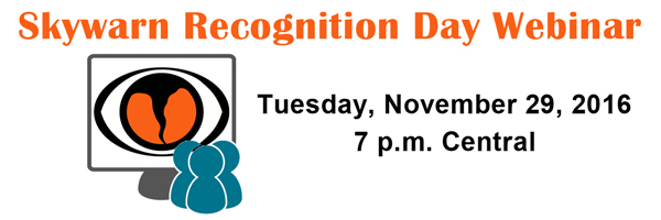
A webinar will be offered on Tuesday, November 29, 2016 at 7 p.m. Central in advance of the 18th SKYWARN Recognition Day (SRD) on December 3, 2016. Click Here to register.

Developed in 1999 by the National Weather Service and the American Radio Relay League, Skywarn Recognition Day celebrates the contributions that Skywarn volunteers make to the mission of the National Weather Service — the protection of life and property. During the Skywarn Special Event, operators visit NWS offices and contact other radio operators across the world. This pre-event webinar will cover Skywarn Recognition Day basics, explain how to participate, and alert participants to a few changes in store for 2016. The webinar will be recorded and posted to the ARRL YouTube channel afterward.

2016 Skywarn Recognition Day

Skywarn Recognition Day

Friday, December 2, 2016 at 6 p.m. Central – Saturday, December 3, 2016 at 6 p.m. Central

(December 3, 2016, from 0000z to 2400z)

Skywarn Recognition Day was developed in 1999 by the National Weather Service and the American Radio Relay League. It celebrates the contributions that volunteer Skywarn radio operators make to the National Weather Service. During the day Skywarn operators visit NWS offices and contact other radio operators across the world.

SKYWARN Recognition Day Operating Instructions

1. Object For all amateur stations to exchange QSO information with as many National Weather Service Stations as possible on 80, 40, 20, 15, 10, 6, and 2 meter bands plus the 70 cm band. Contacts via repeaters are permitted. Skywarn Recognition Day serves to celebrate the contributions to public safety made by amateur radio operators during threatening weather.

2. Date NWS stations will operate December 2, 2016 from 6 p.m. Central – Saturday, December 3, 2016 at 6 p.m. Central (December 3, 2016, from 0000 – 2400 UTC).

3. Exchange: Call sign, signal report, QTH, and a one or two word description of the weather occurring at your site (“sunny”, “partly cloudy”, “windy”, etc.).

4. Modes: NWS stations will work various modes including SSB, FM, AM, RTTY, CW, and PSK31. While working digital modes, special event stations will append “NWS” to their call sign (e.g., N0A/NWS).

5.Station Control Operator: It is suggested that during SRD operations a non-NWS volunteer should serve as a control operator for your station.

6. Event and QSL Information: The National Weather Service will provide event information via the internet. Event certificates will once again be electronic and printable from the main website after the conclusion of SRD.

7. Log Submission: To submit your log summary for SRD use the online submission form.

For More Information

NWS SKYWARN Recognition Day Main Page

Revolutionary Lightning Mapper Launching

Geostationary Lightning MapperImprovement in tornado and severe thunderstorm lead times and false alarm reduction, early warning of lightning ground strike hazards, and improved routing of commercial, military, and private aircraft over oceanic regions where observations of thunderstorm intensity are scarce are just some of the many features that the first operational lightning mapper ever flown in space will provide when the GOES-R Satellite launches this month.

Based on years of research, the Geostationary Lightning Mapper, or GLM, is a revolutionary new instrument that will measure total lightning (in-cloud, cloud-to-cloud and cloud-to-ground) activity continuously over the Americas and adjacent ocean regions with near-uniform spatial resolution.

Severe weather often exhibits a significant increase in lightning activity many minutes before radar can detect a potential storm. This data visualization shows actual lightning measurements captured by an array of ground-based lightning detectors capable of tracing how lightning propagates through the atmosphere. It simulates how the GOES-R Geostationary Lightning Mapper will monitor atmospheric flashes in and around potentially severe weather. This technology could provide critical minutes of valuable warning time in advance of approaching severe storms.

For more information about the Geostationary Lightning Mapper, or GLM, click here

Winter Weather Awareness Day

Although it may not feel like it, winter is coming.  With a developing La Nina in the Pacific Ocean, this may not be the harshest winter on record.  Still, it is wise to be prepared.  That’s why the National Weather Service (NWS) along with the Missouri Department of Public Safety (DPS), Missouri State Emergency Management Agency (SEMA), the Department of Health and Senior Services (DHSS), the Missouri Highway Patrol (MHP), and the State Fire Marshal, has designated November 16, 2016 as Winter Weather Awareness Day for the state of Missouri. Winter storms and cold temperatures can be extremely dangerous. It is recommended that you use this day to review the hazards and safety rules of winter weather so that you are prepared for the upcoming winter season.

For details including fact sheets covering various winter weather safety topics, Click Here

Fall Back: Sunday, November 6th

Fall Back to Standard Time
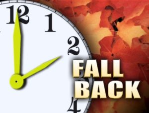
Daylight Savings Time ends this weekend here in Southwest Missouri and throughout most of the United States.  This Sunday, November 6, 2016, at 2:00 a.m. local time, we revert back to Central Standard Time as we turn our clocks back one hour.  Safety officials also suggest that this is a great time to test and/or replace the batteries in your smoke detectors and carbon monoxide detectors.

None of the nets on the Southwest Missouri Regional Skywarn linked repeaters move after these time changes.  All of our nets adhere to local time.  If you monitor our nets on our Broadcastify Feed or if you participate via our EchoLink Node N0NWS-R from parts of the United States and its territories that do not observe Daylight Savings Time including most of Arizona, all of Hawaii, American Samoa, Guam, Puerto Rico, and the Virgin Islands or in other parts of the world that do not observe Daylight Savings Time, then our nets will appear to start an hour later to you.

Daylight Savings Time returns on Sunday, March 12, 2017 at 2:00 a.m. local time.

Ozarks Winter Outlook: Warm

2016-2017 Winter Temperature OutlookForecasters at the National Oceanic and Atmospheric Administration’s Climate Prediction Center say a weak and short-lived La Nina condition over the Pacific Ocean may continue our current warm and dry pattern into this coming winter.  The Climate Prediction Center issued a La Nina watch earlier this October, predicting the climate phenomenon is likely to develop in late fall or early winter. La Nina favors drier, warmer winters in the southern U.S and wetter, cooler conditions in the northern U.S.

According to N.O.A.A., Southwest Missouri falls into the “equal chance” category for precipitation, meaning that there is not a strong enough climate signal in our area to shift the odds.  So we have an equal chance for above-, near-, or below-normal precipitation.

However, the Climate Prediction Center is saying that we do have a greater than 33% chance of above-normal temperatures for this coming winter throughout the Springfield, Missouri County Warning Area.  Given the way this fall has been going, this outlook doesn’t seem far-fetched.

Could this added warmth translate to increased severe weather potential during the late fall and winter months for our area?  Anything is possible, so the best bet is to always remain prepared.

Click Here for the full story from N.O.A.A.

The Great Central U.S. Shakeout

Great Central U.S. ShakeOutAt 10:20 a.m. on October 20, 2016, millions of people “Dropped, Covered, and Held On” in The Great Central U.S. ShakeOut, the region’s largest earthquake drill ever! Participating locally was the Douglas County Amateur Radio Club (D.C.A.R.) which held a net on their repeater at 145.150 (-) PL 162.2.

As we were reminded last month, major earthquakes can happen anywhere you live, work, or travel.  On September 3, 2016, Oklahoma had its strongest earthquake on record measuring a magnitude 5.8.  Many of us throughout the Springfield, Missouri County Warning Area felt this quake – some of us in our western counties quite strongly

The annual ShakeOut drills serve as a chance to practice how to protect ourselves and for everyone to become prepared. The goal is to prevent a major earthquake from becoming a catastrophe.

A “Drop, Cover, and Hold On” drill is important because it teaches us to respond quickly since we may only have seconds to protect ourselves in an earthquake before strong shaking knocks us down, or something falls on us.

Millions of people worldwide have participated in Great ShakeOut Earthquake Drills since 2008. The Great Central U.S. ShakeOut is now held on the third Thursday of October each year.  If you missed this year’s ShakeOut, there’s always next year.  In the meantime, here are some tips on how you and your family can be prepared:

Get Prepared for Earthquakes
• Do a “hazard hunt” for items that might fall during earth
quakes and secure them.
• Create a personal or family disaster plan.
• Organize or refresh your emergency supply kits.
• Identify and correct any issues in your home’s structure.
• Other actions are at www.earthquakecountry.org.

N1CLH: On the Air and In the Air

N1CLH
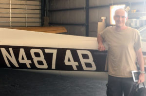
Most of the time, when thinking about amateur radio, we usually consider the location of the person on the other side of the microphone as either being inside their ham shack, driving down the highway, or walking around while talking on their HT. It’s not often when we look up into the friendly skies while trying to make our next contact. That may change in the near future as one of our own Skywarn participants earns his private pilot certificate.

By day, Conway Hawn, N1CLH, practices law in Houston, Missouri. For the past year, during his spare time, he has been working toward meeting the requirements to obtain his private pilot certificate. This entails passing a medical exam, obtaining between 40 and 80 flight hours, passing a written exam, passing an oral exam, and passing a “check ride” with a Designated Pilot Examiner.

“I’m hoping it will take me about another 6 to 12 months to obtain my certificate,” says Hawn who lives 2 1/2 hours round trip from the nearest flight instructor. This long drive, when factored in with his work schedule and other factors, only leaves time for about three lessons per month.

N1CLH took his first solo flight in September in a Cessna 152. “It was a blast!” says an enthusiastic Hawn who has been interested in aviation since he was a young child. “My interest was rekindled last year when I attended a field trip with my son at the local airport,” he says.

With all of his attention focused on learning whatever topic his instructor is trying to teach, N1CLH has not yet had a chance to operate amateur radio from up in the air. He says that may change after he has earned his private pilot certificate. Right now, Conway Hawn, N1CLH, uses his Yaesu FT-1XD HT to monitor local airport traffic on the VHF AM aircraft band. Once he’s in the air and has the ability to operate, he says that we can certainly expect to hear him operating from his aeronautical mobile right here on the Southwest Missouri Regional Skywarn repeater system.

Fall Weather Preparedness Tips

Most of us may think of fall as a relatively calm season bursting with color from beautiful foliage, filled with laughter and fun from hayrides and corn mazes, and stuffed to the gills with turkey and pumpkin pie.  It’s understandable for us to assume that tornadoes only happen in the spring and hurricanes only form during the summer.  For the most part, these assumptions are correct. However, as we’ve been reminded this week, hurricanes and tornadoes are indeed a fall weather hazard too.  In addition, wildfires, intense winds, flooding, droughts, early season snow and more can also occur during the fall months.

Along with keeping our amateur radio equipment ready for emergency use, we should also get ready for fall weather with the following preparedness tips from the National Weather Service. Stay safe this fall!

1. Know Your Risk: Check the Weather Forecast Daily

Start your day with weather.gov, whether it’s on a computer, phone or social media. Check the forecast before you leave home so that you’ll know what to expect during the day.

2. Take Action: Prepare for Weather Hazards

To be weather-ready, it takes more than just knowing the forecast. You must be prepared for it. Get ready with an emergency supplies kit and a family communications plan. An emergency supplies kit is merely a box containing vital supplies that you may need during an emergency, such as food, water and medicine, while a family communications plan lists alternative ways of getting in touch during an emergency.

3. Be A Force of Nature: Share Your Weather Preparedness Story

You are influential. Take a photo of your emergency supplies kit and share it on social media, or simply go next door and talk to the neighbors about what to do if a storm strikes. Building a Weather-Ready Nation is a job for all of us. If you’re looking for things to share, see the info-graphics and social media plans in the sidebar. They’re free to take and share with your family and friends.